All Destinations
Expedition Intelligence·Southwest Colorado, Colorado

Alpine Loop: Ouray to Silverton

High-altitude passes through the San Juan Mountains

Difficulty: 7/10Duration: 3-4 DaysDistance: ~65 miles (Alpine Loop)Elevation: 8,800 - 12,800 ftSeason: July - September

OVERVIEW

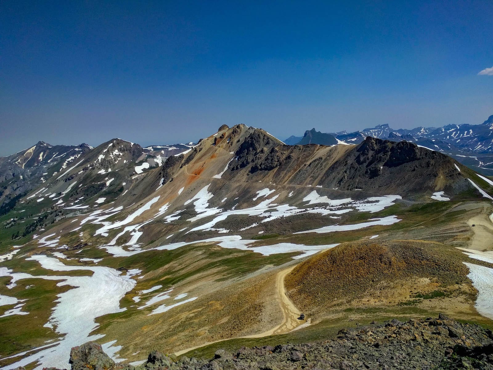
The San Juan Mountains of southwest Colorado contain some of the most spectacular high-altitude 4x4 trails in North America. The Alpine Loop is a 65-mile backcountry byway that crosses two passes above 12,000 feet, passing through the ruins of Colorado's silver mining era. The towns of Ouray ('Switzerland of America'), Silverton, and Lake City serve as base camps for exploring dozens of additional trails including Imogene Pass, Black Bear Pass, and Ophir Pass. The scenery is genuinely world-class — towering 13,000 and 14,000-foot peaks, cascading waterfalls, and alpine tundra carpeted with wildflowers in July and August.

Alpine Loop: Ouray to Silverton
EXPEDITION INTELLIGENCETRAIL READINESS
72READY
GOOD
Weather
90
Season
30
Trail
88

INTERACTIVE TRAIL MAP

All 8 trail stops, 5 campgrounds, 5 restaurants, and 8 points of interest plotted on the map with the GPX route.

Interactive Trail Map
1. Ouray Trailhead (Engineer Pass)
2. Mineral Point
3. Engineer Pass Summit (12,800 ft)
4. Animas Forks Ghost Town
5. Cinnamon Pass Summit (12,620 ft)
6. Lake City Arrival
7. Silverton Main Street
8. Black Bear Pass (Optional)
Amphitheater Campground
South Mineral Campground
Animas Forks Dispersed
Hinsdale County Campground
4J+1+1 RV Park
Bon Ton Restaurant
Maggie's Kitchen
Handlebars Food & Saloon
Packer Saloon & Cannibal Grill
Mouse's Chocolates & Coffee
Ouray Hot Springs Pool
Box Canyon Falls
Durango & Silverton Narrow Gauge Railroad
Ice Lake Basin
Animas Forks Ghost Town
Bear Creek Falls
Million Dollar Highway
Alferd Packer Massacre Site
Google
Map data ©2026 Google
Trail Stops (8)
campgrounds (5)
restaurants (5)
Points of Interest (8)
GPX Route